| 7301 |

|
87100462 |
印刷物
Printed Material |
[地図等]
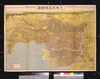
最新詳密金刺分県図 熊本県全図
Latest Detailed Map of Prefectures, Complete Map of Kumamotoken |
木崎盛政 |
20世紀 |
| 7302 |
|
87100463 |
印刷物
Printed Material |
[地図等]
最新詳密金刺分県図 宮崎県全図
Latest Detailed Map of Prefectures, Complete Map of Miyazakiken |
木崎盛政 |
20世紀 |
| 7303 |
|
87100464 |
印刷物
Printed Material |
[地図等]
最新詳密金刺分県図 鹿児島県全図
Latest Detailed Map of Prefectures, Complete Map of Kagoshimaken |
木崎盛政 |
20世紀 |
| 7304 |
|
87100465 |
印刷物
Printed Material |
[地図等]
最新詳密金刺分県図 沖縄県全図
Latest Detailed Map of Prefectures, Complete Map of Okinawaken |
木崎盛政 |
20世紀 |
| 7305 |
|
87100466 |
印刷物
Printed Material |
[地図等]
最新詳密金刺分県図 台湾 北部
Latest Detailed Map of Prefectures, Northern Taiwan |
木崎盛政 |
20世紀 |
| 7306 |
|
87100467 |
印刷物
Printed Material |
[地図等]
最新詳密金刺分県図 台湾 南部
Latest Detailed Map of Prefectures, Southern Taiwan |
木崎盛政 |
20世紀 |
| 7307 |
|
87100468 |
印刷物
Printed Material |
[地図等]
最新詳密金刺分県図 樺太全図
Latest Detailed Map of Prefectures, Complete Map of Karafuto |
木崎盛政 |
20世紀 |
| 7308 |
|
87100469 |
印刷物
Printed Material |
[地図等]
最新詳密金刺分県図 朝鮮 北部
Latest Detailed Map of Prefectures, Northern Korea |
木崎盛政 |
20世紀 |
| 7309 |
|
87100470 |
印刷物
Printed Material |
[地図等]
最新詳密金刺分県図 朝鮮 中央部
Latest Detailed Map of Prefectures, Central Korea |
木崎盛政 |
20世紀 |
| 7310 |
|
87100471 |
印刷物
Printed Material |
[地図等]
最新詳密金刺分県図 朝鮮 南部
Latest Detailed Map of Prefectures, Southern Korea |
木崎盛政 |
20世紀 |
| 7311 |
|
87100472 |
印刷物
Printed Material |
[地図等]
最新詳密金刺分県図 南満州
Latest Detailed Map of Prefectures, South Manchuria |
木崎盛政 |
20世紀 |
| 7312 |
|
87100473 |
印刷物
Printed Material |
[地図等]
日本旅行案内図
Japan Travel Guide Map |
- |
20世紀 |
| 7313 |
|
87100502 |
印刷物
Printed Material |
[地図等]
東京郊外住宅地域図 参謀本部陸地測量部20万分之一
Tokyo Suburban Residential Area Map, Land Survey Department, Imperial Japanese Army General Staff Office, 1:200,000 |
- |
20世紀 |
| 7314 |
|
87100503 |
印刷物
Printed Material |
[地図等]
東京市神田区三崎町一丁目一番地換地決定図
Finalized Map of Land Replotment at 1-1 Misakichō, Kandaku, Tokyoshi |
- |
20世紀 |
| 7315 |
|
87100504 |
印刷物
Printed Material |
[地図等]
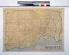
新大東京全図
New Complete Map of Greater Tokyo |
有田元三郎/著 |
20世紀 |
| 7316 |
|
87100505 |
印刷物
Printed Material |
[地図等]
改正番地入東京市全図 里程町名早わかり
Revised Complete Map of Tokyoshi With Lot Numbers, Quick Guide to Distances and Town Names |
遠藤政賢/著 |
20世紀 |
| 7317 |
|
87100506 |
印刷物
Printed Material |
[地図等]
更新東京市全図 附大東京地勢交通図
Updated Complete Map of Tokyoshi, With Topography and Transportation Maps of Greater Tokyo |
- |
20世紀 |
| 7318 |
|
87100508 |
印刷物
Printed Material |
[地図等]
復興完成記念東京市街地図 附大東京交通図
Map of the City of Tokyo in Commemoration of the Successful Restoration, With Transportation Map of Greater Tokyo |
復興局 |
20世紀 |
| 7319 |
|
87100510 |
印刷物
Printed Material |
[地図等]
東京市市域変遷図
Map of Changes to the City Limits of Tokyoshi |
- |
20世紀 |
| 7320 |
|
87100511 |
印刷物
Printed Material |
[地図等]
最新大東京全図
Latest Complete Map of Greater Tokyo |
小林又七/著 |
20世紀 |
| 7321 |
|
87100512 |
印刷物
Printed Material |
[地図等]
東京市向島区新町名地番入明細全図 向島区防護本部防護計画図
Complete Detailed Map of Mukōjimaku, Tokyoshi With New Town Names and Lot Numbers, Mukōjimaku Protection Headquarters Protection Plan |
学生聯盟行名清幸 |
20世紀 |
| 7322 |
|
87100513 |
印刷物
Printed Material |
[地図等]
大東京区分図三十五区之内 世田谷区詳細図 附大東京交通地図
Detailed Map of Setagayaku from the Maps of the 35 Wards of Greater Tokyo, With Transportation Map of Greater Tokyo |
植野録夫 |
20世紀 |
| 7323 |
|
87100518 |
印刷物
Printed Material |
[地図等]
大東京区分図三十五区之内 浅草区詳細図
Detailed Map of Asakusaku from the Maps of the 35 Wards of Greater Tokyo |
植野録夫 |
20世紀 |
| 7324 |
|
87100525 |
印刷物
Printed Material |
[地図等]
大東京区分図三十五区之内 芝区詳細図
Detailed Map of Shibaku from the Maps of the 35 Wards of Greater Tokyo |
植野録夫 |
20世紀 |
| 7325 |
|
87100515 |
印刷物
Printed Material |
[地図等]
新東京近郊回遊一覧
New Tokyo Suburban Tour List |
金子常光 |
20世紀 |
| 7326 |
|
87100516 |
印刷物
Printed Material |
[地図等]
新東京便覧 附旧東京市赤くなる支那
New Tokyo Guidebook, With Former Tokyoshi and China Turning Red |
相馬基 |
20世紀 |
| 7327 |
|
87100517 |
印刷物
Printed Material |
[地図等]
大東京市制記念大東京之鳥瞰図(国民新聞附録)
Bird's-eye View of Greater Tokyo in Commemoration of the Greater Tokyo Municipal Organization (Kokumin Shimbun Supplement) |
楓井金之助 |
20世紀 |
| 7328 |
|
87100519 |
印刷物
Printed Material |
[地図等]
携帯用大東京案内図(東京日日新聞社附録)
Portable Greater Tokyo Guide Map (Tokyo Nichi Nichi Shimbun Supplement) |
相馬基 |
20世紀 |
| 7329 |
|
87100520 |
印刷物
Printed Material |
[地図等]
東京近郊 五万分之一都市近郊図
Tokyo and Its Suburbs, 1:50,000 Map of the City and Its Suburbs |
陸地測量部/編 |
20世紀 |
| 7330 |
|
87100521 |
印刷物
Printed Material |
[地図等]
新旧町名対照番地入新大東京区分地図 附電車自動車運転系統図
New Map of the Wards of Greater Tokyo With New and Old Town Names and Lot Numbers, With Train and Automobile Route Map |
- |
20世紀 |
| 7331 |
|
87100522 |
印刷物
Printed Material |
[地図等]
新東京遊覧地図 電車自動車乗換早わかり
New Tokyo Sightseeing Map, Quick Guide to Train and Automobile Transfers |
- |
20世紀 |
| 7332 |
|
87100523 |
印刷物
Printed Material |
[地図等]
新制三十五区鮮明改正町名番地入大東京市全図 官公署・学校・名勝遊覧案内
Complete Map of Tokyoshi With the 35 Newly Established Wards, Revised Town Names and Lot Numbers Clearly Indicated, Guide to Government Offices, Schools, and Tours of Scenic Spots |
東京市芝公園 馬場日良/著 |
20世紀 |
| 7333 |
|
87100524 |
印刷物
Printed Material |
[地図等]
ポケット型東京区分地図 第56版
Pocket Map of Tokyo Wards, 56th Edition |
森田義春 |
20世紀 |
| 7334 |
|
87100526 |
印刷物
Printed Material |
[地図等]
最新大東京案内図
Latest Guide Map of Greater Tokyo |
植野録夫/著 |
20世紀 |
| 7335 |
|
87100527 |
印刷物
Printed Material |
[地図等]
町村行程運転系統早わかり東京電車案内
Quick Guide to Trains in Tokyo With Distances and Routes Between Towns and Villages |
植野録夫 |
20世紀 |
| 7336 |

|
87100528 |
印刷物
Printed Material |
[地図等]
東京三十五区分図 麹町区全図
Map of the 35 Wards of Tokyo, Complete Map of Kōjimachiku |
内山善三郎/編 |
20世紀 |
| 7337 |
|
87100529 |
印刷物
Printed Material |
[地図等]
東京三十五区分図 神田区全図
Map of the 35 Wards of Tokyo, Complete Map of Kandaku |
内山善三郎/編 |
20世紀 |
| 7338 |
|
87100530 |
印刷物
Printed Material |
[地図等]
東京三十五区分図 日本橋区全図
Map of the 35 Wards of Tokyo, Complete Map of Nihombashiku |
内山善三郎/編 |
20世紀 |
| 7339 |
|
87100531 |
印刷物
Printed Material |
[地図等]
東京三十五区分図 京橋区全図
Map of the 35 Wards of Tokyo, Complete Map of Kyōbashiku |
内山善三郎/編 |
20世紀 |
| 7340 |
|
87100532 |
印刷物
Printed Material |
[地図等]
東京三十五区分図 芝区全図
Map of the 35 Wards of Tokyo, Complete Map of Shibaku |
内山善三郎/編 |
20世紀 |
| 7341 |
|
87100533 |
印刷物
Printed Material |
[地図等]
東京三十五区分図 麻布区全図
Map of the 35 Wards of Tokyo, Complete Map of Azabuku |
内山善三郎/編 |
20世紀 |
| 7342 |
|
87100534 |
印刷物
Printed Material |
[地図等]
東京三十五区分図 赤坂区全図
Map of the 35 Wards of Tokyo, Complete Map of Akasakaku |
内山善三郎/編 |
20世紀 |
| 7343 |
|
87100535 |
印刷物
Printed Material |
[地図等]
東京三十五区分図 四谷区全図
Map of the 35 Wards of Tokyo, Complete Map of Yotsuyaku |
内山善三郎/編 |
20世紀 |
| 7344 |
|
87100536 |
印刷物
Printed Material |
[地図等]
東京三十五区分図 牛込区全図
Map of the 35 Wards of Tokyo, Complete Map of Ushigomeku |
内山善三郎/編 |
20世紀 |
| 7345 |
|
87100537 |
印刷物
Printed Material |
[地図等]
東京三十五区分図 小石川区全図
Map of the 35 Wards of Tokyo, Complete Map of Koishikawaku |
内山善三郎/編 |
20世紀 |
| 7346 |
|
87100538 |
印刷物
Printed Material |
[地図等]
東京三十五区分図 本郷区全図
Map of the 35 Wards of Tokyo, Complete Map of Hongōku |
内山善三郎/編 |
20世紀 |
| 7347 |
|
87100539 |
印刷物
Printed Material |
[地図等]
東京三十五区分図 下谷区全図
Map of the 35 Wards of Tokyo, Complete Map of Shitayaku |
内山善三郎/編 |
20世紀 |
| 7348 |
|
87100540 |
印刷物
Printed Material |
[地図等]
東京三十五区分図 浅草区全図
Map of the 35 Wards of Tokyo, Complete Map of Asakusaku |
内山善三郎/編 |
20世紀 |
| 7349 |
|
87100541 |
印刷物
Printed Material |
[地図等]
東京三十五区分図 本所区全図
Map of the 35 Wards of Tokyo, Complete Map of Honjoku |
内山善三郎/編 |
20世紀 |
| 7350 |
|
87100542 |
印刷物
Printed Material |
[地図等]
東京三十五区分図 麹町区全図
Map of the 35 Wards of Tokyo, Complete Map of Kōjimachiku |
内山善三郎/編 |
20世紀 |
| 7351 |
|
87100543 |
印刷物
Printed Material |
[地図等]
東京三十五区分図 品川区全図
Map of the 35 Wards of Tokyo, Complete Map of Shinagawaku |
内山善三郎/編 |
20世紀 |
| 7352 |
|
87100544 |
印刷物
Printed Material |
[地図等]
東京三十五区分図 目黒区全図
Map of the 35 Wards of Tokyo, Complete Map of Meguroku |
内山善三郎/編 |
20世紀 |
| 7353 |
|
87100545 |
印刷物
Printed Material |
[地図等]
東京三十五区分図 荏原区全図
Map of the 35 Wards of Tokyo, Complete Map of Ebaraku |
内山善三郎/編 |
20世紀 |
| 7354 |
|
87100546 |
印刷物
Printed Material |
[地図等]
東京三十五区分図 大森区全図
Map of the 35 Wards of Tokyo, Complete Map of Ōmoriku |
内山善三郎/編 |
20世紀 |
| 7355 |
|
87100547 |
印刷物
Printed Material |
[地図等]
東京三十五区分図 蒲田区全図
Map of the 35 Wards of Tokyo, Complete Map of Kamataku |
内山善三郎/編 |
20世紀 |
| 7356 |
|
87100548 |
印刷物
Printed Material |
[地図等]
東京三十五区分図 世田谷区全図
Map of the 35 Wards of Tokyo, Complete Map of Setagayaku |
内山善三郎/編 |
20世紀 |
| 7357 |
|
87100549 |
印刷物
Printed Material |
[地図等]
東京三十五区分図 渋谷区全図
Map of the 35 Wards of Tokyo, Complete Map of Shibuyaku |
内山善三郎/編 |
20世紀 |
| 7358 |
|
87100550 |
印刷物
Printed Material |
[地図等]
東京三十五区分図 淀橋区全図
Map of the 35 Wards of Tokyo, Complete Map of Yodobashiku |
内山善三郎/編 |
20世紀 |
| 7359 |
|
87100551 |
印刷物
Printed Material |
[地図等]
東京三十五区分図 中野区全図
Map of the 35 Wards of Tokyo, Complete Map of Nakanoku |
内山善三郎/編 |
20世紀 |
| 7360 |
|
87100552 |
印刷物
Printed Material |
[地図等]
東京三十五区分図 杉並区全図
Map of the 35 Wards of Tokyo, Complete Map of Suginamiku |
内山善三郎/編 |
20世紀 |
| 7361 |
|
87100553 |
印刷物
Printed Material |
[地図等]
東京三十五区分図 豊島区全図
Map of the 35 Wards of Tokyo, Complete Map of Toshimaku |
内山善三郎/編 |
20世紀 |
| 7362 |
|
87100554 |
印刷物
Printed Material |
[地図等]
東京三十五区分図 滝野川区全図
Map of the 35 Wards of Tokyo, Complete Map of Takinogawaku |
内山善三郎/編 |
20世紀 |
| 7363 |
|
87100555 |
印刷物
Printed Material |
[地図等]
東京三十五区分図 荒川区全図
Map of the 35 Wards of Tokyo, Complete Map of Arakawaku |
内山善三郎/編 |
20世紀 |
| 7364 |
|
87100556 |
印刷物
Printed Material |
[地図等]
東京三十五区分図 王子区全図
Map of the 35 Wards of Tokyo, Complete Map of Ōjiku |
内山善三郎/編 |
20世紀 |
| 7365 |
|
87100557 |
印刷物
Printed Material |
[地図等]
東京三十五区分図 板橋区全図
Map of the 35 Wards of Tokyo, Complete Map of Itabashiku |
内山善三郎/編 |
20世紀 |
| 7366 |
|
87100558 |
印刷物
Printed Material |
[地図等]
東京三十五区分図 足立区全図
Map of the 35 Wards of Tokyo, Complete Map of Adachiku |
内山善三郎/編 |
20世紀 |
| 7367 |
|
87100559 |
印刷物
Printed Material |
[地図等]
東京三十五区分図 向島区全図
Map of the 35 Wards of Tokyo, Complete Map of Mukōjimaku |
内山善三郎/編 |
20世紀 |
| 7368 |
|
87100560 |
印刷物
Printed Material |
[地図等]
東京三十五区分図 城東区全図
Map of the 35 Wards of Tokyo, Complete Map of Jōtōku |
内山善三郎/編 |
20世紀 |
| 7369 |
|
87100561 |
印刷物
Printed Material |
[地図等]
東京三十五区分図 葛飾区全図
Map of the 35 Wards of Tokyo, Complete Map of Katsushikaku |
内山善三郎/編 |
20世紀 |
| 7370 |
|
87100562 |
印刷物
Printed Material |
[地図等]
東京三十五区分図 江戸川区全図
Map of the 35 Wards of Tokyo, Complete Map of Edogawaku |
内山善三郎/編 |
20世紀 |
| 7371 |
|
87100563 |
印刷物
Printed Material |
[地図等]
戦災焼失区域表示 帝都近傍図 新制二十二区補入
Map of Imperial Capital and Its Vicinity Showing War-damaged and Burnt-down Areas, With the 22 Newly Established Wards Added |
亀井豊治 |
20世紀 |
| 7372 |
|
87100564 |
印刷物
Printed Material |
[地図等]
最新大東京全図
Latest Complete Map of Greater Tokyo |
吉田喜太郎/著 |
20世紀 |
| 7373 |
|
87100565 |
印刷物
Printed Material |
[地図等]
新二十三区東京都区分地図帖 都内各区町村名行程早わかり
Map of the New 23 Wards of Tokyo, Quick Guide to Distance and Names of All Wards, Towns and Villages |
五十嵐久雄/編 |
20世紀 |
| 7374 |
|
87100566 |
印刷物
Printed Material |
[地図等]
東京都区分地集 町名・番地入
Compilation of the Wards of Tokyo, With Town Names and Lot Numbers |
小島新作 |
20世紀 |
| 7375 |
|
87100567 |
印刷物
Printed Material |
[地図等]
東京特別都市計画図 防火地域・空地地区・復興土地計画・整理区域・用途地域・街路・公園・緑地
Tokyo Special City Plan Map, Fire Prevention Districts, Vacant Land Districts, Reconstruction Plans, Readjustment Districts, Use Districts, Streets, Parks, Green Spaces |
山本林太郎 |
20世紀 |
| 7376 |
|
87100568 |
印刷物
Printed Material |
[地図等]
都区内交通路線網 昭和28年4月現在
Metropolitan Transportation Route Network, As of April 1953 |
東京都交通局・編 |
20世紀 |
| 7377 |
|
87100569 |
印刷物
Printed Material |
[地図等]
淺草絵図
Map of Asakusa |
紫花菱 |
20世紀 |
| 7378 |
|
87100570 |
印刷物
Printed Material |
[地図等]
淺草絵図
Map of Asakusa |
紫花菱 |
20世紀 |
| 7379 |
|
87100571 |
印刷物
Printed Material |
[地図等]
大東京立体地図
Three-dimensional Map of Greater Tokyo |
新倉俊太郎 |
20世紀 |
| 7380 |
|
87100572 |
印刷物
Printed Material |
[地図等]
大東京立体地図
Three-dimensional Map of Greater Tokyo |
新倉俊太郎 |
20世紀 |
| 7381 |
|
87100573 |
印刷物
Printed Material |
[地図等]
池袋 1:10,000地形図 東京6号東京西北部の4
1:10,000 Topographic Map of Ikebukuro, Tokyo No. 6, Northwestern Tokyo Part 4 |
地理調査所 |
20世紀 |
| 7382 |
|
87100574 |
印刷物
Printed Material |
[地図等]
上野 1:10,000地形図 東京2号東京東北部の24
1:10,000 Topographic Map of Ueno, Tokyo No. 2, Northeastern Tokyo Part 24 |
地理調査所 |
20世紀 |
| 7383 |
|
87100575 |
印刷物
Printed Material |
[地図等]
上野 1:10,000地形図 東京2号東京東北部の24
1:10,000 Topographic Map of Ueno, Tokyo No. 2, Northeastern Tokyo Part 24 |
地理調査所 |
20世紀 |
| 7384 |
|
87100576 |
印刷物
Printed Material |
[地図等]
日本橋 1:10,000地形図 東京2号東京東北部の25
1:10,000 Topographic Map of Nihombashi, Tokyo No. 2, Northeastern Tokyo Part 25 |
国土地理院 |
20世紀 |
| 7385 |
|
87100577 |
印刷物
Printed Material |
[地図等]
千代田区神田中央部詳細図
Detailed Map of Central Kanda, Chiyodaku |
- |
20世紀 |
| 7386 |
|
87100578 |
印刷物
Printed Material |
[地図等]
東京都市計画図 第一輯 一.千代田区
Tokyo City Plan Map, Vol. 1, Part 1, Chiyodaku |
- |
20世紀 |
| 7387 |
|
87100579 |
印刷物
Printed Material |
[地図等]
東京都市計画図 第一輯 二.中央区
Tokyo City Plan Map, Vol. 1, Part 2, Chūōku |
- |
20世紀 |
| 7388 |
|
87100580 |
印刷物
Printed Material |
[地図等]
東京都市計画図 第一輯 三.港区(芝区)
Tokyo City Plan Map, Vol. 1, Part 3, Minatoku (Shibaku) |
- |
20世紀 |
| 7389 |
|
87100581 |
印刷物
Printed Material |
[地図等]
東京都市計画図 第一輯 四.新宿区
Tokyo City Plan Map, Vol. 1, Part 4, Shinjukuku |
- |
20世紀 |
| 7390 |
|
87100582 |
印刷物
Printed Material |
[地図等]
東京都市計画図 第一輯 五.文京区
Tokyo City Plan Map, Vol. 1, Part 5, Bunkyōku |
- |
20世紀 |
| 7391 |
|
87100583 |
印刷物
Printed Material |
[地図等]
東京都市計画図 第一輯 六.台東区
Tokyo City Plan Map, Vol. 1, Part 6, Taitōku |
- |
20世紀 |
| 7392 |
|
87100584 |
印刷物
Printed Material |
[地図等]
東京都市計画図 第一輯 七.墨田区
Tokyo City Plan Map, Vol. 1, Part 7, Sumidaku |
- |
20世紀 |
| 7393 |
|
87100585 |
印刷物
Printed Material |
[地図等]
東京都市計画図 第一輯 八.江東区
Tokyo City Plan Map, Vol. 1, Part 8, Kōtōku |
- |
20世紀 |
| 7394 |
|
87100586 |
印刷物
Printed Material |
[地図等]
東京都市計画図 第一輯 九.品川区
Tokyo City Plan Map, Vol. 1, Part 9, Shinagawaku |
- |
20世紀 |
| 7395 |
|
87100587 |
印刷物
Printed Material |
[地図等]
東京都市計画図 第一輯 十.大田区
Tokyo City Plan Map, Vol. 1, Part 10, Ōtaku |
- |
20世紀 |
| 7396 |
|
87100588 |
印刷物
Printed Material |
[地図等]
東京都市計画図 第一輯 十一.北区
Tokyo City Plan Map, Vol. 1, Part 11, Kitaku |
- |
20世紀 |
| 7397 |
|
87100589 |
印刷物
Printed Material |
[地図等]
東京都市計画図 第一輯 十二.目黒区
Tokyo City Plan Map, Vol. 1, Part 12, Meguroku |
- |
20世紀 |
| 7398 |
|
87100590 |
印刷物
Printed Material |
[地図等]
東京都市計画図 第一輯 十三.世田谷区
Tokyo City Plan Map, Vol. 1, Part 13, Setagayaku |
- |
20世紀 |
| 7399 |
|
87100591 |
印刷物
Printed Material |
[地図等]
東京都市計画図 第一輯 十四.渋谷区
Tokyo City Plan Map, Vol. 1, Part 14, Shibuyaku |
- |
20世紀 |
| 7400 |
|
87100592 |
印刷物
Printed Material |
[地図等]
東京都市計画図 第一輯 十五.中野区
Tokyo City Plan Map, Vol. 1, Part 15, Nakanoku |
- |
20世紀 |